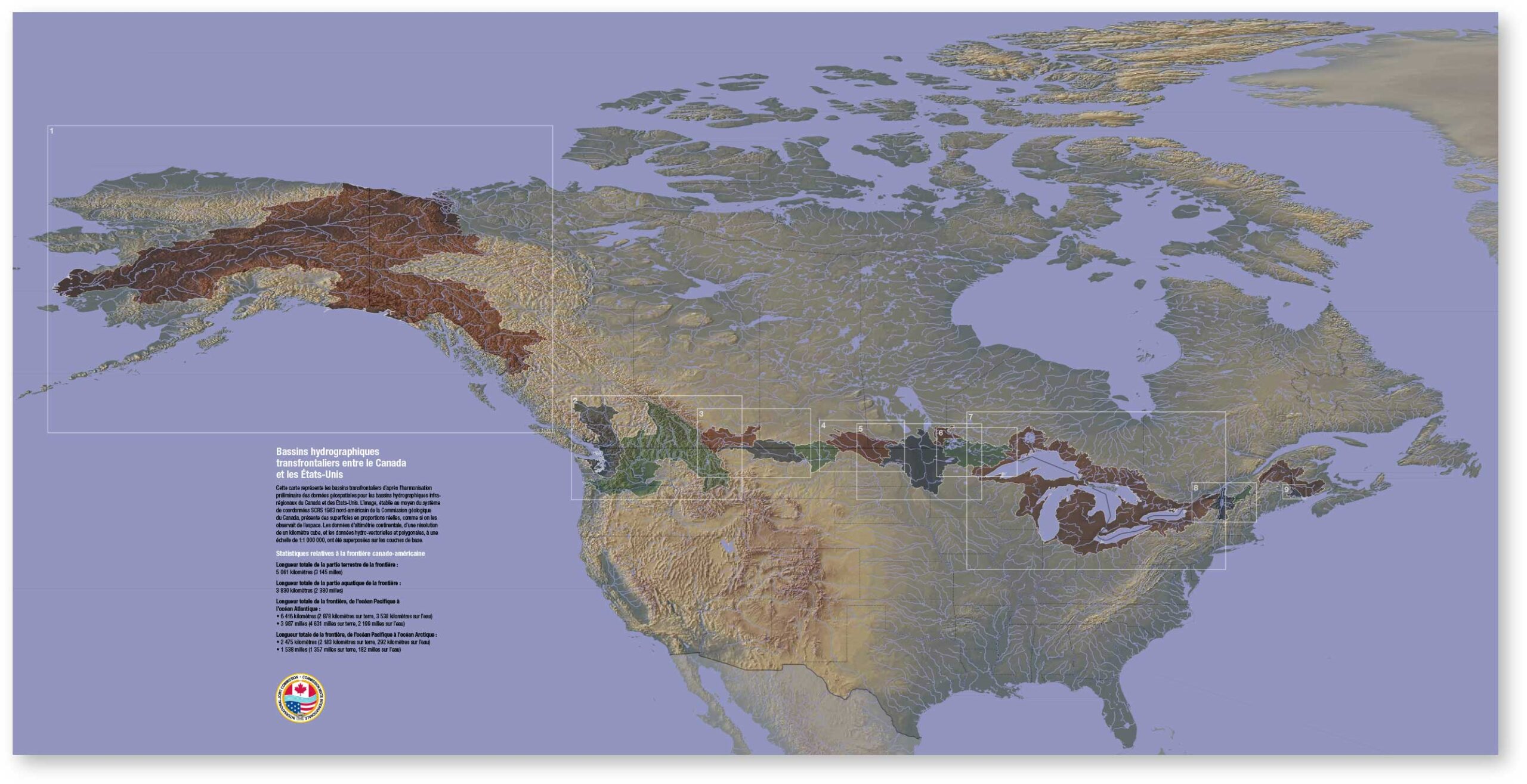
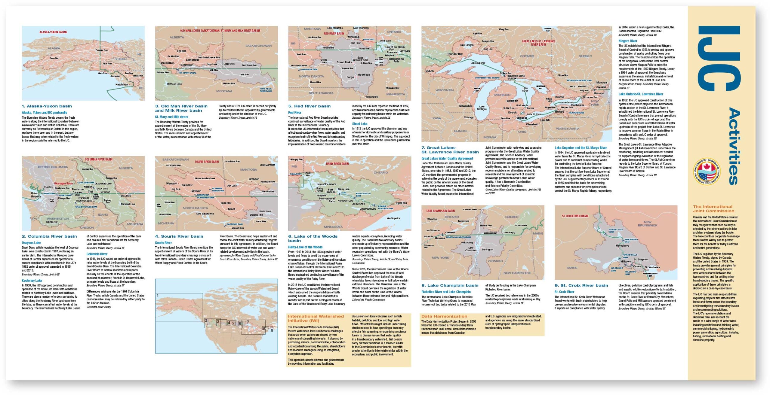
Designed for the International Joint Commission (IJC), this bilingual map showcases the vast network of cross-border water governance efforts between Canada and the United States. Despite the complexity of the subject matter—covering nine transboundary basins and multiple treaties, agreements, and jurisdictional boards—the map was created to be easily readable, highly accurate, and accessible to diverse audiences.
Balancing simplicity with detail, the design had to convey dense information clearly while maintaining geographic accuracy. This required careful coordination with stakeholders on both sides of the border and the ability to distill extensive technical input into a visually elegant, data-rich output.
While I provided creative direction and project oversight—among other tasks—for most of my portfolio samples, the final outcome reflects a collaborative process. I worked closely with professionals across disciplines, including writers, developers, illustrators, photographers, printers, and fellow designers. My role included guiding strategy and execution while empowering others to contribute their strengths. I believe leadership in design means conducting the orchestra, not playing every instrument.
